May 8 2022 thoughts
The fire started up by Sierra Los Pinos in the Jemez on April 22 (happy Earth Day.. ugh!) It has been mixed conditions (primarily wind related) – one crazy wind and smokey day (on the start day) and we got 80% ready to evacuate (animal carriers assembled and right by the door, for example). Everyone (lab, county, forest, NNSA/DC, individuals) is watching the fire closely and making plans for many contingencies.
Today (May 8, happy Mother’s Day??) is dry and windy and the start of “100 hours of red flag conditions.” I was supposed to go on work travel but cancelled. This morning I’ve been watching fire information, air fire-fighting and fire-mapping, and remember some good adventures in that area of the Jemez. This post is semi-therapeutic, semi-informative for others perhaps.
I saw this image of current aircraft and fire status and I decided to add a few photos from semi-recent activities up there – you can see the fuel load and what is going on. This image is from ~9am this morning (May 8):
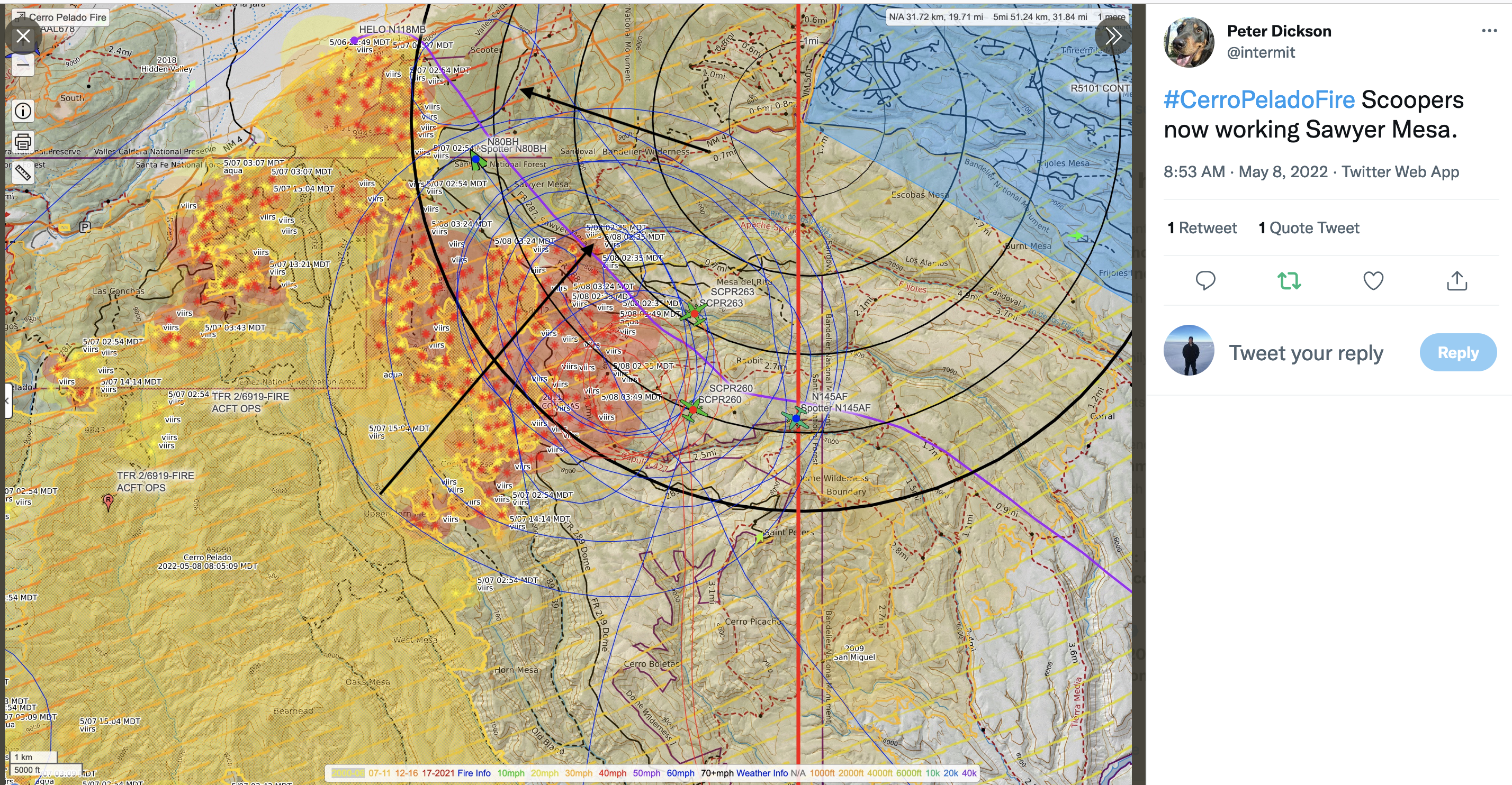
Th map is a bit busy, so here goes: the radial black rings are distance from NM4 and NM501 intersection aka “back gate.” Each ring is a mile.
Red are IR hot spots (very likely fire, but need to be confirmed).
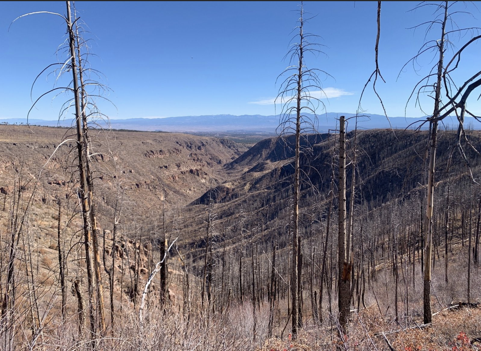
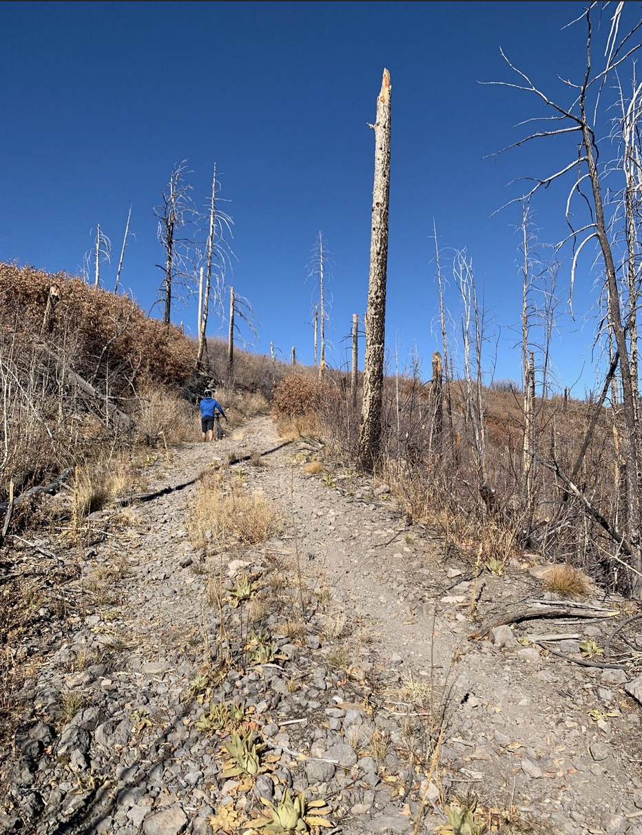
Blue tracks are various fire fighting/support planes. I added two black arrows. The lower arrow is the start of the narrow spot of FR 287 heading out Sawyer Mesa. Last Nov 6 2021, I rode this with Shawn and Mike. You might be able to view the route and two other photos near here on strava. Two photos taken really close to the head of the lower black arrow (and right at the NE corner of the fire by IR) are below. You can see – fire has burned there before, not lots of crowning opportunity for the current fire or live trees right here, but still fuel, and super dry.
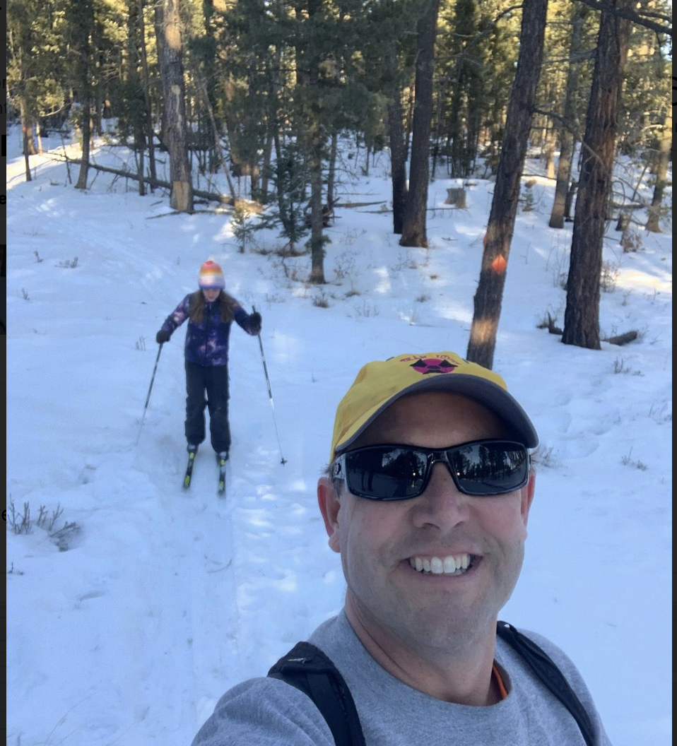
Next, is a more recent photo – from Jan 9, 2022. Aven and I went up to cross country ski. The photo is taken near the head of upper black arrow in the first map. You may be able to check the track and photo at strava. In the photo below, you can see more live trees (fuel.. ugh..) than out Obsidian Ridge (the two photos above). The snow sure looks nice but that is all gone and not much moisture at all up there right now.
We are watching the fire carefully, thinking of everyone up there – people who live up there and are evacuated, the fire fighting crew (THANK YOU!), and everyone impacted and stressed out by the smoke, wind, dry, and uncertainty. Everyone stay safe!